Highway US-26 Traffic & Road Conditions in Oregon
Oregon DOT Traffic Cameras
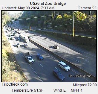
US26 at Zoo Bridge
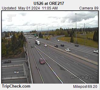
US26 at ORE217
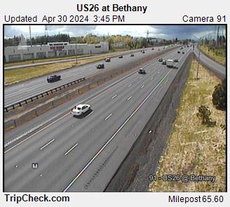
US26 at Bethany

US26 at Jefferson Off-Ramp
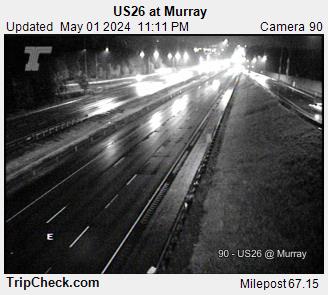
US26 at Murray
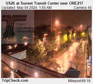
US26 at Sunset Transit Center near ORE217
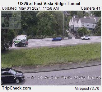
US26 at East Vista Ridge Tunnel
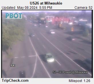
US26 at Milwaukie
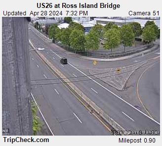
US26 at Ross Island Bridge
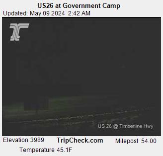
US26 at Government Camp
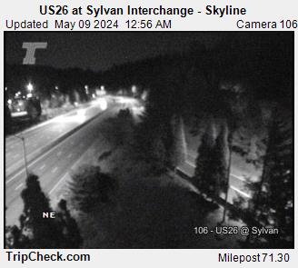
US26 at Sylvan Interchange - Skyline
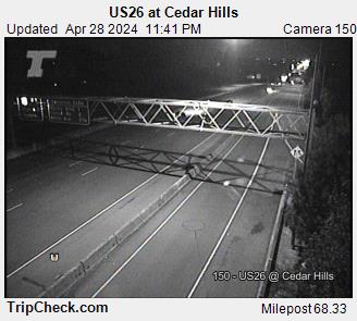
US26 at Cedar Hills
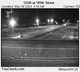
US26 at 185th Street
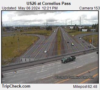
US26 at Cornelius Pass
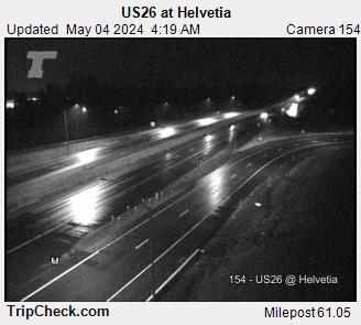
US26 at Helvetia
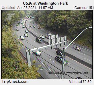
US26 at Washington Park
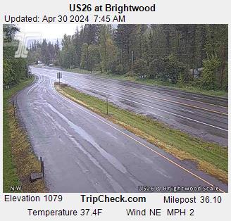
US26 at Brightwood
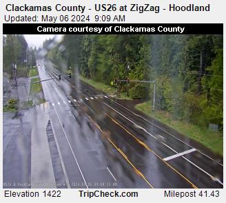
Clackamas County - US26 at ZigZag - Hoodland
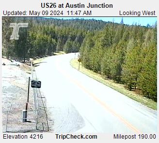
US26 at Austin Junction
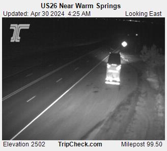
US26 Near Warm Springs
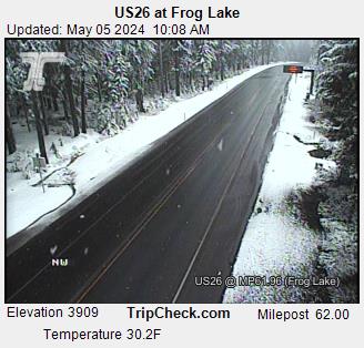
US26 at Frog Lake
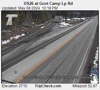
US26 at Govt Camp Lp Rd
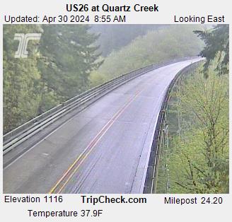
US26 at Quartz Creek
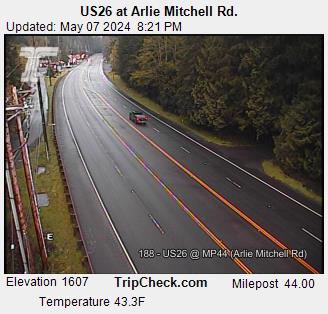
US26 at Arlie Mitchell Rd.
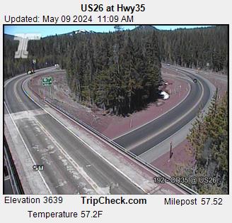
US26 at Hwy35
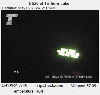
US26 at Trillium Lake
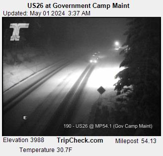
US26 at Government Camp Maint
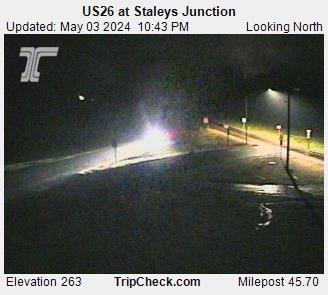
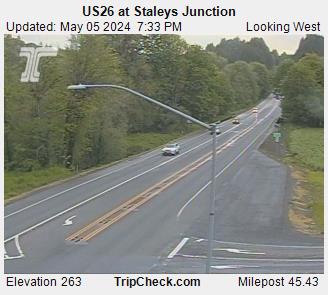
US26 at Staleys Junction
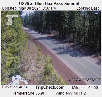
US26 at Blue Box Pass Summit
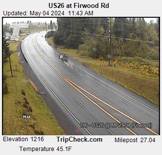
US26 at Firwood Rd
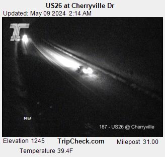
US26 at Cherryville Dr
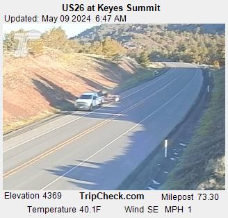
US26 at Keyes Summit
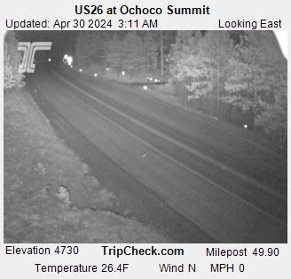
US26 at Ochoco Summit
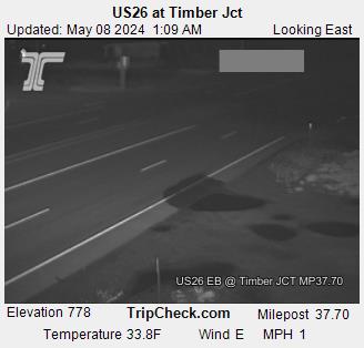
US26 at Timber Jct
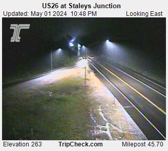
US26 at Staleys Junction
US26 at Staleys Junction

US26 at 21st
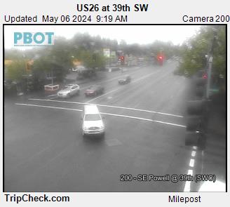
US26 at 39th SW

US26 at SE 26th

US26 at SE 33rd
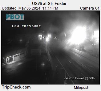
US26 at SE Foster
US26 at SE 39th
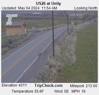
US26 at Unity

US26 at Camelot Court Overpass
US26 at Brogan Hill
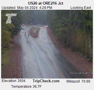
US26 at ORE216 Jct
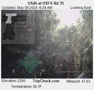
US26 at USFS Rd 35
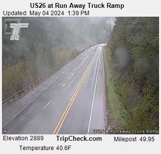
US26 at Run Away Truck Ramp
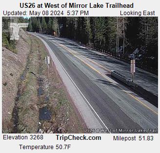
US26 at West of Mirror Lake Trailhead
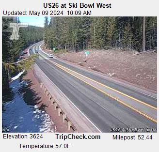
US26 at Ski Bowl West
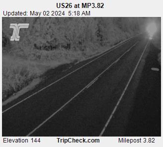
US26 at MP3.82
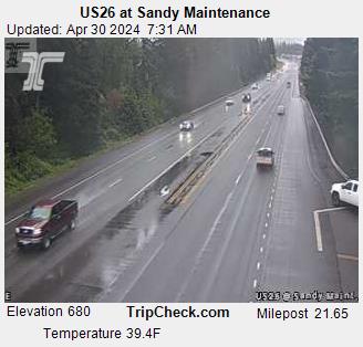
US26 at Sandy Maintenance
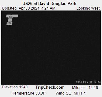
US26 at David Douglas Park
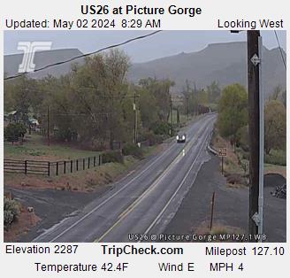
US26 at Picture Gorge
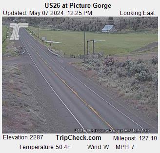
US26 at Picture Gorge
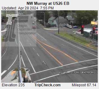
NW Murray at US26 EB
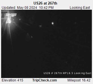
US26 at 267th
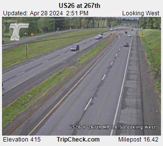
US26 at 267th
TripCheck Oregon Incidents (13)
Bridge Work - Estimated delay under 20 minutes
MCMINNVILLE SPUR
Bridge work is occurring. Prepare to slow.
Bridge work continues. Use caution. Expect traffic delays of up to 20 minutes several through early 2024.
<!--Links Start Here-->
[Link to Additional Information](https://www.oregon.gov/odot/projects/pages/project-details.aspx?project=19389)
Road Construction - Informational Only
MT. HOOD
US26, Portland
Lane closures, traffic shifts, shoulder closures and up to 20-minute traffic holds weekdays.
Lane closures from 8 a.m. to 5 p.m. and at night from 9 p.m. to 5 a.m.
Road Construction - Estimated delay under 20 minutes
MT. HOOD
US26, 3 miles West of Welches
Periodic shoulder closures.
<!--Links Start Here-->
[Link to Additional Information](https://www.oregon.gov/odot/projects/pages/project-details.aspx?project=21599)
Road Construction - No to Minimum Delay
JOHN DAY
US26, Prairie City
Road construction is occurring causing minimal delay to traffic. Use caution and watch for workers.
Road Construction - No to Minimum Delay
JOHN DAY
US26, John Day
Road construction is occurring causing minimal delay to traffic. Use caution and watch for workers.
Road Construction - No to Minimum Delay
JOHN DAY
US26, Dayville
Road construction is occurring causing minimal delay to traffic. Use caution and watch for workers.
Road Construction - No to Minimum Delay
JOHN DAY
US26, Mount Vernon
Road construction is occurring causing minimal delay to traffic. Use caution and watch for workers.
Sunken Grade - No to Minimum Delay
SUNSET
US26, 5 miles East of Necanicum
Sunken pavement is causing minimal delay to traffic. Use caution.
East
Road Construction - No to Minimum Delay
OCHOCO
ORE126, Prineville
Road construction is occurring causing minimal delay to traffic. Use caution and watch for workers.
Crews will have daytime shoulder closures and lane shifts on US26 Monday-Friday. Claypool St will have closure from 4th to 5th Street. Access from US26 to Deer will be closed with detours.
<!--Links Start Here-->
[Link to Additional Information](https://www.oregon.gov/odot/projects/pages/project-details.aspx?project=20268)
Road Construction - Estimated delay under 20 minutes
HISTORIC COLUMBIA RIVER
HWY100, 5 miles West of Ainsworth State Park
Lane closures with flaggers directing traffic weekdays between 6-9 a.m.
Project description: Two 100 year-old elevated roadways that provide access to Multnomah Falls require repairs to continue providing access to one of Oregon's most iconic sites. The elevated roadways – called viaducts – carry vehicles and bicycles to the Falls and Lodge from the Historic Columbia River Highway. The west viaduct will be closed fall 2024 through spring 2025. The east viaduct will be closed fall 2025 through spring 2026.
<!--Links Start Here-->
[Link to Additional Information](https://www.oregon.gov/odot/Regions/Pages/ColumbiaGorgeProjects.aspx)
- No to Minimum Delay
OCHOCO
West
Road Construction - No to Minimum Delay
SUNSET
US26, 1 mile East of Cornelius Pass Exit
No traffic impacts.
<!--Links Start Here-->
[Link to Additional Information](https://www.oregon.gov/odot/projects/pages/project-details.aspx?project=21597)
Road Construction - No to Minimum Delay
SUNSET
US26, 1 mile West of Necanicum
Road construction is occurring causing minimal delay to traffic. Use caution and watch for workers.
<!--Links Start Here-->
[Link to Additional Information](https://www.oregon.gov/odot/projects/pages/project-details.aspx?project=21224)
US-26 Major Junctions (11)
View incidents along related routes
![Route US-101]() Seaside, Oregon
Seaside, Oregon![Route OR-217]() in Beaverton
in Beaverton![Route I-405]() in Portland
in Portland![Route I-5]() in Portland
in Portland![Route I-205]() in Portland
in Portland![Route US-97]() in Madras
in Madras![Route OR-126]() in Prineville
in Prineville![Route US-395]() in John Day
in John Day![Route US-20]() in Vale
in Vale![Route US-20]() Idaho
Idaho![Route US-26]() Idaho
Idaho
No active ODOT Message Signs found.