Highway OR-569 Traffic & Road Conditions in Oregon
Oregon DOT Traffic Cameras
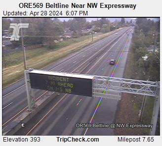
ORE569 Beltline Near NW Expressway

ORE569 Beltline at Delta Hwy
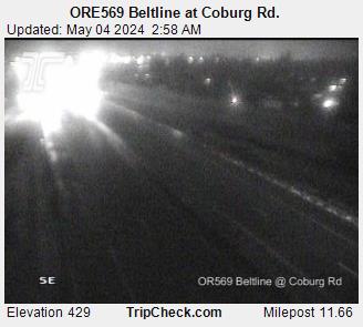
ORE569 Beltline at Coburg Rd.
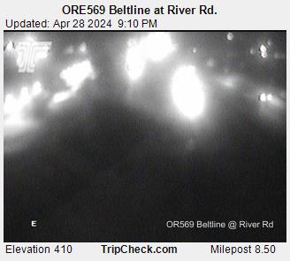
ORE569 Beltline at River Rd.
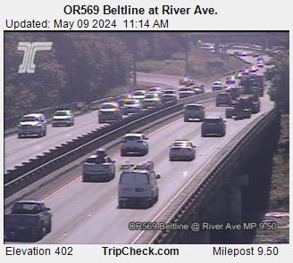
OR569 Beltline at River Ave.
TripCheck Oregon Incidents (4)
West
Pothole - No to Minimum Delay
BELTLINE
ORE569, Eugene
There is a pothole in the lane of travel causing minimal delay to traffic. Use caution. Ramps Affected.
Road Construction - Estimated delay under 20 minutes
HISTORIC COLUMBIA RIVER
HWY100, 5 miles West of Ainsworth State Park
Lane closures with flaggers directing traffic weekdays between 6-9 a.m.
Project description: Two 100 year-old elevated roadways that provide access to Multnomah Falls require repairs to continue providing access to one of Oregon's most iconic sites. The elevated roadways – called viaducts – carry vehicles and bicycles to the Falls and Lodge from the Historic Columbia River Highway. The west viaduct will be closed fall 2024 through spring 2025. The east viaduct will be closed fall 2025 through spring 2026.
<!--Links Start Here-->
[Link to Additional Information](https://www.oregon.gov/odot/Regions/Pages/ColumbiaGorgeProjects.aspx)
East
Road Construction - Estimated delay under 20 minutes
BELTLINE
ORE569, Intersection with Pacific Highway West ORE99W
Road construction is occurring. Prepare to slow. Watch for workers.
Work is expected to resume in early April. Expect delays, construction noise, lane and ramps closures as needed at NW Expressway Bridge on Beltline Hwy (OR569) on eastbound and westbound lanes. Detours will be posted for ramp closures.
<!--Links Start Here-->
[Link to Additional Information](https://www.oregon.gov/odot/projects/pages/project-details.aspx?project=21261)
Bridge Work - Estimated delay under 20 minutes
MCMINNVILLE SPUR
Bridge work is occurring. Prepare to slow.
Bridge work continues. Use caution. Expect traffic delays of up to 20 minutes several through early 2024.
<!--Links Start Here-->
[Link to Additional Information](https://www.oregon.gov/odot/projects/pages/project-details.aspx?project=19389)
OR-569 Major Junctions (1)
View incidents along related routes
No active ODOT Message Signs found.